January 2, 2012

New Years Day, a Hiking Complex


At its root, hiking is simple. You learn the basic skill for hiking—walking— in your first year or so of life. But at its best, when it is done right hiking is beautifully complex. Physical exhaustion, mental reward, danger, spiritual gain; I find all and more on my best hikes. New Year's Day was one-such hike

Undercast clouds pour over the Southern Presidential Peaks. New Years Day 2012. From the Gulfside Trail.
We started before sunrise. And finished after sunset. We spent 12 hours on our feet and managed little more than a stagger for the final flat mile. The route wasn't heroic and our pace wasn't worthy of a stopwatch, but neither were our goals. We wanted a good, a solid, hike. A nice walk.

Sinking waste deep into a snowdrift, my first step above tree line didn't go well. Two quick and easy miles before sunrise, with little more than a dusting of snow underfoot, had made a bit complacent. The forecast—mild temperatures, light winds and a clear sky—couldn't have been better, but as I hauled myself free of the drift, looked up and saw the gray inside of a cloud covering the rocks and snow that supposedly led to the summit of Mt. Washington, I was reminded of how little forecasts can mean up here.

Fortunately for us, where we headed was soon above the clouds and the sun soon followed us, rising into the blue bird morning from the fog that filled the valleys with a blanket that stretched to the horizon. The first sunrise of the New Year will be a tough act to follow.

Stacey enjoying the view on Mt. Washington's Boot Spur just after sunrise.
We climbed Mt. Washington's summit cone like a spiral staircase, wrapping our way from the rim of Tuckerman's Ravine up and around to the Crawford Path and marching rhythmically onto the summit, home of the "World's Worst Weather" and world-record winds. We sat down with our dogs and had a snack. Stacey couldn't have asked for a better day—tame weather, no crowds, no cars and no train—for her first trip to the summit of Mt. Washington, but I looking more forward to showing her the ranges real, more wild peaks, Jefferson and Adams.

First, the bliss hit. After leaving the summit, on the Northern snowfields of Mt. Washington, Espresso and Charlotte, having apparently expended no energy thus far, frolicked. Sprinting amongst the snowdrifts, they played, and barked, and otherwise unleashed the inner puppy they both so seldom show in their doggy-years old age. Above all else, we hike for fun. And while Stacey and I are strict with our pups when hiking, keeping our pack tight both for safety and out of respect for the hills, this time we couldn't help but just smile and let them play because to play, in such a rugged, unforgiving, often harsh and treacherous place, is a privilege, and they earned it.

Stepping over the iced over tracks of the Cog Railroad, we got back to business. Soon, we were clipping ropes to each dog and white knuckling our way along the rim of the Great Gulf, peering down into the abyss as we hiked the short section of trail that runs closest to the drop.Once we hit the slopes of Mt. Clay, the clouds, which had been undercast in the valleys below, began to blow up and over us, reducing our world to a small bubble of rocks and snow that blurred into a dense fog. Its inevitable that such a change in the weather, pristine blue sky to nothing but gray, will put you slightly on edge, but we confidently trudged onward.

Stacey in the fog, after robing Espresso's bandana to shield her face from the wind.
We headed back above the clouds and into the clear over the summit of Jefferson, through Edmands Col and along the slopes of Mt. Sam Adams. But by the time we hit Thunderstorm Junction, with darkness an hour or so away, there was a decision to be made about summating Adam. Do we climb it, or skirt around it and head down? Up we went. The wind had increased, gusting enough to knock us off balance on our rubbery legs. It was getting colder. And we were tired. And we were out of water. We were clearly pushing our luck on what had so far been a near perfect hike.

We hit the summit of Adams and looked over the other side. A wall of clouds raced up at us from the valley below. In an instant, the view was gone. Rocks, snow and clouds. I know Mt. Adam's well and I've managed to lose my way leaving its summit on more than one occasion. We had a map and compass, but orienteering in such a situation... well, it wouldn't be fun. Fortunately, there were faint crampon markings in the wind-packed snow. They zigzagged between the rocks and led from cairn to cairn. Soon, we were below the clouds, and not long after we dropped into the col between Mt. Adams and Madison—as close to home as I can get in the mountains. We passed the hut and headed down Valley way. Four miles to go. In the dark, we staggered to the truck.

Stacey braving the elements.
There is work to be done on a hike. Navigation. Safety. Basic responsibility. You need to keep your guard slightly raised, especially in winter. But a good hike has so many isolated moments. There's time for casual chit-chat, serious discussion and witty nonsense. There is room for Quakerly periods with no discussion at all. Just you, the mountains and your thoughts. Personal time. We had 12 hours free of any other distractions and we made the most of it.

Happy New Year.


September 3, 2011

The Crawford Notch Outlaws

"Road Closed." The sign leaves little for debate. The State Police Cruiser, blues flashing, parked sideways straddling the yellow line, emphasizes the point. The orange dump truck blocking the road adds muscle to the message.

The rules don't apply to us though. We avoid the sign, the fuzz and the wide load and zoom down into The Notch. Windows down we whip around the corners, riding the edge of the crumbled shoulder. For miles we have the road to ourselves, scarred river banks on one side, bulldozed rock slides on the other.

We're outlaws.

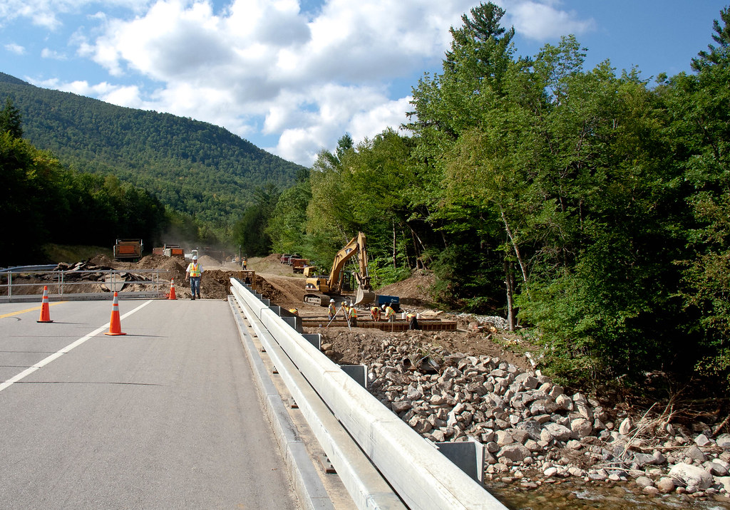
Bridge out ahead! Looks like its the end of the road toots.

We slow down, pull into the dirt parking lot (full of cars belonging to other outlaws), gather our belongs and stroll across the crumbled bridge, waving to the construction workers along the way. Once on the other side, we jump into our getaway vehicle, and speed home.

Yeaaaaahhh. Outlaws.

End of the road toots. The Route 302 Gap as of 9-1-11. 


August 31, 2011

Our Hurricane Story

It wasn't long after I finished my eggs, sunny-side up, when it really started to rain. It had rained all night, but this post-breakfast rain was the real deal, the torrential sort. The rain would pound down relentlessly. At times we'd think "Hey, it let up a little..." before looking up and noticing that the "lulls" still had rain coming down in visible sheets.

The Highland Center sits at 2000' on an open plot of land, the highest ground on Rt. 302 through Crawford Notch. The Southern end of the Presidential Range rises across the road to the East and three 4000' peaks (Willey, Tom and Field) rise up just out the door to the west.

We had prepped the grounds for Irene, storing all the patio furniture, turning over benches and stashing flower boxes. Our only action during the storm was checking windows for leaks (there were many) and periodically checking the historic train depot, a short drive away in the JCB loader.

Three times during the storm Stacey and I ventured down Rt 302 into the Notch in my truck. The motivation of the trips was partly to look for any standard hikers, but also curiosity, wanting to see what we've never seen, and probably will never see, again.

On the first trip we made it three miles South, passed the Willey House historic site to where the Appalachian Trail crosses the road before heading up into the Presidentials.

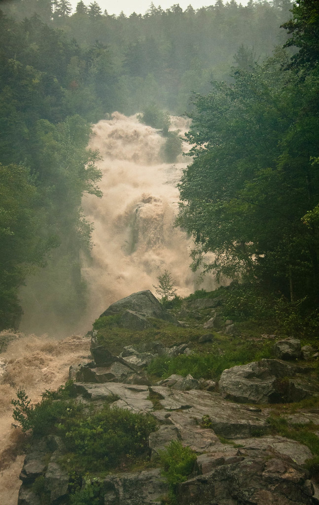
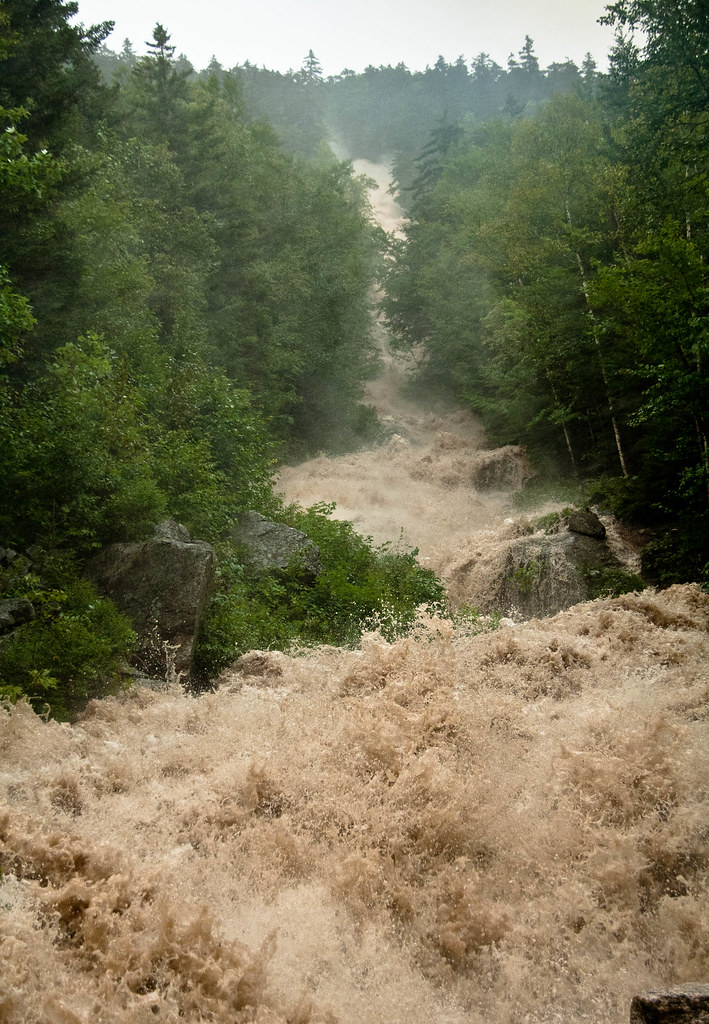
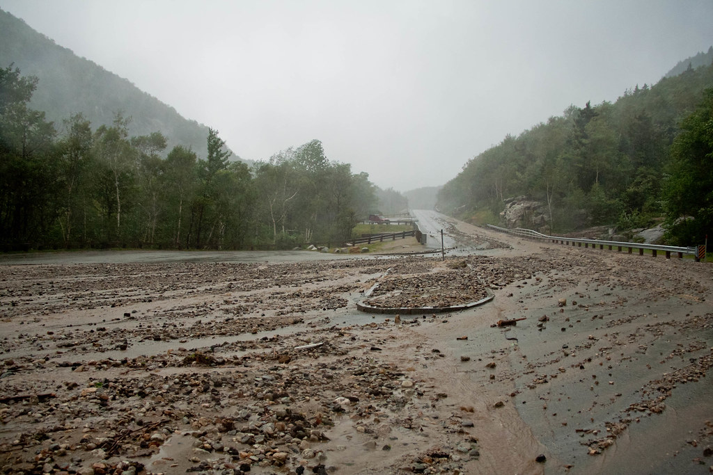
On our second trip down into the Notch we barely made it around Saco Lake, which was now across the road, taking a small hiking bridge with it. The Silver and Flume cascades, normally narrow bands of water that gently trace their way down a swath of cliffs, were ragging torrents of water ready to overtake the road at any moment.


That's Silver Cascade at 1:30 p.m. during Irene. This is Silver Cascade on a normal day


Flume Cascade during Irene. And now, Flume on a normal day

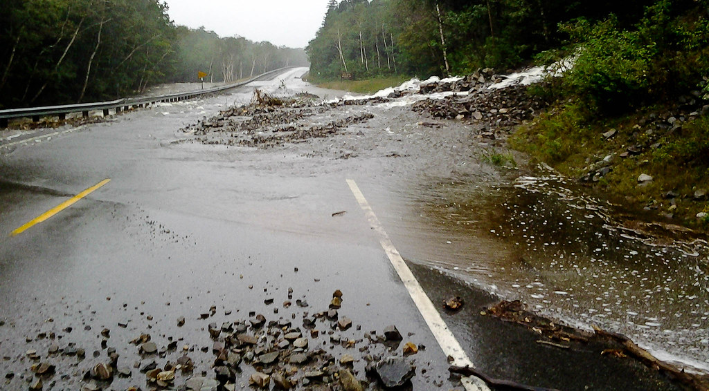
On this trip into the Notch we were turned around short of the Willey House. A new stream (there had never been one here before) had punched its way out of the side of the mountain and across the road, along with a pile of debris. 


On our third trip, we didn't make it passed the two cascades. The water had actually begun to recede, but  at some point in the two hours since our last trip into the Notch, the cascades jumped the road we had been driving, leaving a delta of mud and rocks, some the size of basketballs. 


The road on the uphill side had been undermined by the rushing water, dropping the pavement down five feet in places and washing sections of granite curbing downhill.

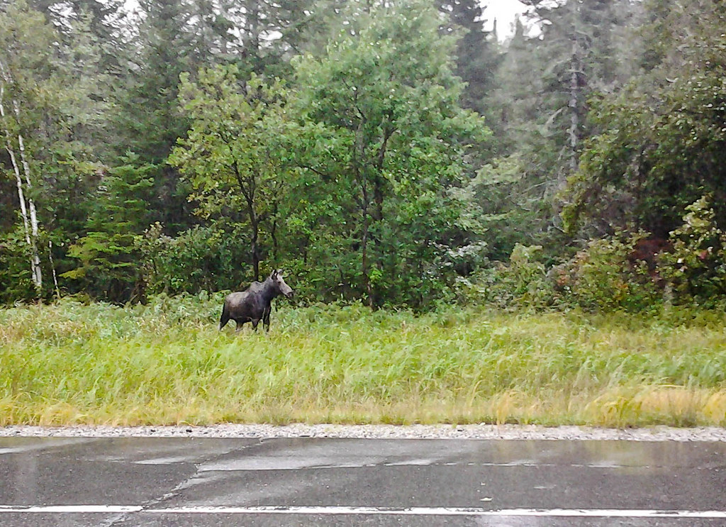
The storm pulled away in the early evening. The Highland Center was almost completely unharmed, with only a few newly planted trees bent to the ground. Stacey and I toured North along 302, where we saw a young-male mouse grazing peacefully along the road, isolated by flood waters.


Later we'd learn that there has been a slide at the Willey House historic site (which we had driven by earlier in the day) that trapped two cars, which N.H. Fish and Game pulled free later that night. No one was injured.

Amazingly, the Willey House site is historic for a reason not unlike this story. In the early 1800's the Willey House had a house and barn on the site. A drought, followed by torrential rains, unleashed a landslide that killed all seven members of the family and two hired men. The family had fled their house for a "safe" cave during the night, leaving beds unmade and a bible open, but didn't make it to the cave before the slide swept them away. The house, built in 1793 and the first in the Notch, was left untouched by the slide.

The tragedy occurred on August 28, 1826.

185 years before Irene, to  the day.

Stacey and I did some work around the Highland Center Monday, repairing stone dust that had washed out of the patio built earlier in the summer and putting patio furniture back in place. Finally, that afternoon, we (the dogs included) made it home for the first time in three days. The drive took an hour and a half, and hour longer than usual. With Rt. 302 so badly damaged, we had to go North and East to Rt. 16 and through Pinkham Notch, where the roads were badly damaged, but passable. The long commute may be the norm for awhile.

Our new house was unharmed, thankfully. One road down, closer to the East Branch River, was a different story, with the road completely washed away in places and homes damaged. Many other parts of our town didn't fare well either.

August 25, 2011

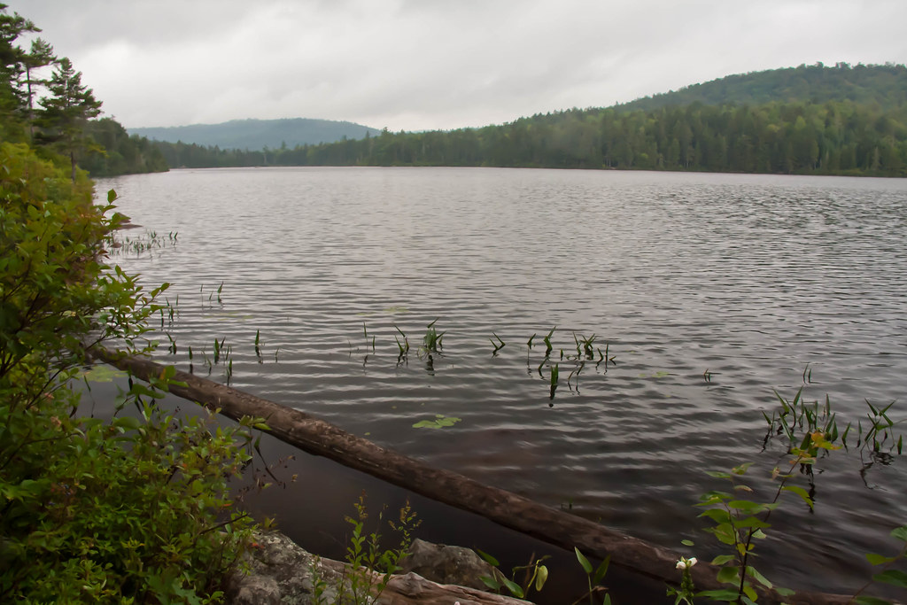
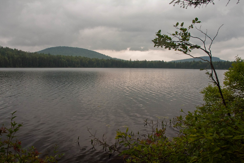
Mountain Pond

We had a productive morning of splitting firewood, transplanting ferns and, okay, I sat on the couch some too, but then it was time for a walk in the woods.

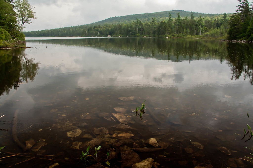
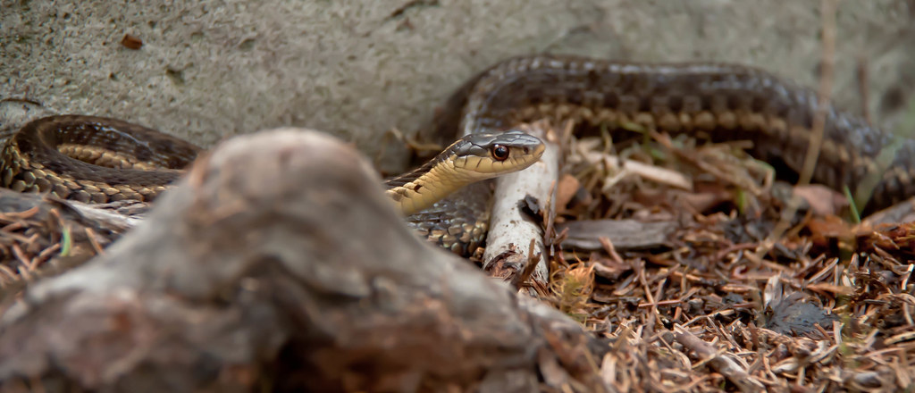
A 10-minute drive on unpaved roads got Stacey and I to the trailhead for Mountain Pond. Three miles, a snake, a wood pecker and a giant, appropriately named, mountain pond. Not bad for a mostly rainy day off.


June 10, 2011

From Madison to Crawford

Looking South from the Highland Center in Crawford Notch. (AMC Photo)
A Presidential Traverse, it's the best known long-hike in the White Mountains, 19.2 miles if you hit all the summits—an elevation gain of almost 9000'. Typically hikers start with Mt. Madison and hike south, ascending Mt. Washington in the middle of the hike, then finishing with the Southern Presidentials, descending into Crawford Notch.

Now I am on my way, from Madison to Crawford Notch. One week after my time on Madison ended, I accept a full-time position with the AMC as the Maintenance Supervsior for the Highland Center in Crawford Notch. A nationally recognized adventure lodge—Outside Magazine placed it in its top 10.

The seed for all of this began in September 2009 while I was, appropriately, doing a Presidential Traverse. Just after sunset, with a full moon rising, I took a rest stop at the OLD Madison Hut. I tied Espresso outside and made my way inside to the bathroom (now the Star Lake bunkroom). On the wall I saw a sign, soliciting funds for the upcoming Madison rebuild project. I filled the information away.

Six-months later, frustrated with my job and sitting at home, I wrote a letter (e-mail).

I began the letter with:
I am writing to enquire about the possibility of joining the AMC construction crew that will be renovating the Madison Hut this coming fall and spring. I am a full-time carpenter with 10-plus years experience, I have a passion for the White Mountains and am experienced in the Northern Presidential Range in all seasons...
And ended it with:
I enjoy my current work as a carpenter but am looking to make it both more challenging and more rewarding. Working with the AMC on the Madison Hut would fulfill both of these goals while also getting my foot in the door with an organization I admire and would love to work for.
Thank you for your time and consideration.
I sent the e-mail to any AMC address I could find with hopes that it would eventually be forwarded into the correct hands. It was, and I got the job as a seasonal employee. However, I was warned at the time that the chances of it leading to a full-time position were slim to none. Staff jobs with the AMC are few and far between and highly competitive.

Well, less than a year after writing the letter, here I am, AMC Staff, and I feel happy of myself (click for video). Thumbs up for rock and roll!

The Photo above is looking South from the main Highland Center Lodge. The lake is Saco Lake, the headwaters for the Saco River. The two buildings that can be seen are train depots used by the Conway Scenic Railroad, which my great uncle, Dwight Smith, founded in 1974 and has since sold. The depot buildings are two of the seven buildings that I will be responsible for. I'll post more about the history of Crawford Notch...sometime.